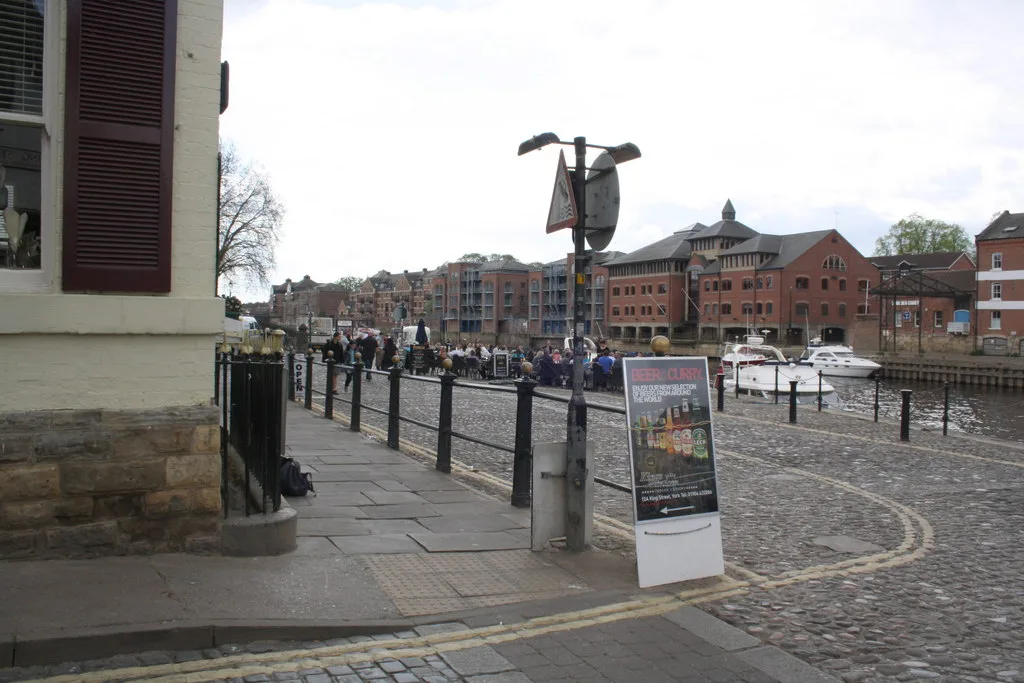

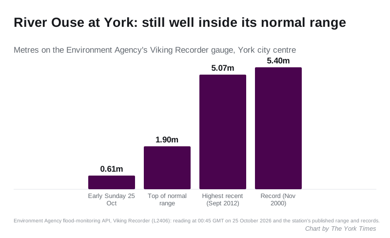
The Ouse at York read 0.61m early on Sunday, far below the 1.9m top of its normal range, and the official five-day flood risk is very low. What to watch.
There is no flood warning or flood alert anywhere in York as Storm Boelo passes, and the official forecast puts the city’s flood risk for the next five days at very low.
The River Ouse has risen since Friday, but only a little. The Environment Agency’s gauge in the city centre read 0.61 metres at 1.45am on Sunday 25 October, up from about 0.32m on Friday afternoon. The top of the river’s normal range at that gauge is 1.9m (Environment Agency, Viking Recorder gauge).
Some reports on Saturday said flooding was expected in York. The official figures do not show that. The Environment Agency’s Check for flooding service said at 1am on Sunday that there were “no flood warnings or alerts in this area”. Its five-day forecast, produced with the Met Office and last updated at 10.30am on Saturday, says: “The flood risk for the next 5 days is very low.”
Why the river could still rise
York’s river problems usually arrive a day or more after the rain, once water from the Dales has come down the Ure and the Swale. That is the part to watch.
The Environment Agency has a flood alert on the Upper River Ure, upstream of York. Its message, last changed at 9.54pm on Saturday, says rain from the storm was expected to be heaviest on Saturday afternoon and evening, and that showery weather on Sunday “may keep river levels high”. It says low-lying land and roads near the river are most at risk, and that it may issue flood warnings if levels rise further. It promised an update by 10am on Sunday (Environment Agency flood warnings).
The gauges upstream of the city were inside their normal ranges early on Sunday. Naburn Lock, downstream, was above the top of its normal range:
| Gauge | Reading, early Sunday 25 October | Top of normal range |
|---|---|---|
| Monkton, Beningbrough (upstream) | 0.63m | 6.75m |
| Skelton, Nether Poppleton (upstream) | 1.14m | 6.1m |
| Viking Recorder, York city centre | 0.61m | 1.9m |
| Naburn Lock (downstream) | 3.62m | 2.25m |
Each gauge has its own scale, so the numbers cannot be compared with each other, only with each gauge’s own normal range. Naburn is below the city, about four miles south, and the Environment Agency has no alert there either.
The wind warning
The Met Office has a yellow warning for wind covering York until 9pm on Sunday 25 October. An amber wind warning covers North Yorkshire from 8pm on Saturday to 9pm on Sunday (Met Office warnings for Yorkshire and Humber).
National Rail says the storm may affect journeys until Monday 26 October. In York that comes on top of the planned closure of the line south: no trains run between York and Doncaster, Leeds or Selby today. Our roadworks and travel page and our story on the half-term rail closures have the detail.
What it means for you
- No York homes are under a flood warning or alert as of early Sunday.
- If the Ouse does rise, the Environment Agency has named flood warning areas for the city. They include King’s Staith and the riverside from Lendal Bridge to Millennium Bridge, Queen’s Staith with South Esplanade and Tower Place, and Peckitt Street with Clifford Street.
- St George’s Field car park sits in the floodplain. The council says it may shut the car park as a precaution when the river is high, even before water gets in (City of York Council). Do not leave a car there overnight if a warning is issued.
- Sign up for free flood warnings by phone, text or email through the Environment Agency, or call Floodline on 0345 988 1188, 24 hours a day.
- Check before you go on the Check for flooding service, which updates through the day.
Sources
- Environment Agency: Viking Recorder gauge, range and records and current flood warnings and alerts
- Environment Agency: Check for flooding in York, with the five-day forecast
- Met Office: UK weather warnings
- City of York Council: St George’s Field car park
River readings taken from the Environment Agency’s live data at about 1am on Sunday 25 October 2026. Levels change; check the live pages above.
Have your say